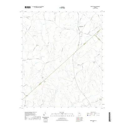
2020 Map of White Plains
USGS Topo · Published 2020About this map
White Plains serves as the primary hub of this rural landscape, situated at a junction where Old Greensboro Rd and Sparta Rd meet. The area is defined by a series of creek drainages including Pierce Cr and Moores Cr, which feed into larger water systems across the Greene Co and Hancock Co borders. A distinctive feature near the Taliaferro County line is The Blue Hole, a water body that stands out among the localized drainage networks of Johnson Cr and Copeland Cr.
Find a feature on this map
67 named features on this map. Tap any name to fly to it.
Don’t see what you’re looking for? This feature index may not catch every label — zoom into the map to look around manually.
Map Details
Editions of this 2020 White Plains Map
This is the sole edition of this map. No revisions or reprints were ever made.
Other maps of this area

1906 · Crawfordville
USGS Topo · 1:125,000

1953 · Athens
USGS Topo · 1:250,000

1958 · Athens
USGS Topo · 1:250,000

1959 · Athens
USGS Topo · 1:250,000

1963 · Athens
USGS Topo · 1:250,000

1965 · Union Point
USGS Topo · 1:24,000

1966 · Crawfordville
USGS Topo · 1:24,000

1972 · Liberty
USGS Topo · 1:24,000

1972 · Shoulderbone
USGS Topo · 1:24,000

1972 · Sparta NW
USGS Topo · 1:24,000