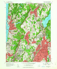
1957 Map of White Plains
USGS Topo · Published 1963About this map
The Hudson River and the newly completed Tappan Zee Bridge define the western edge of this Westchester County landscape during a period of significant suburban expansion. Major infrastructure projects like the New York State Thruway and Sprain Brook Pkwy are shown cutting through established communities from North Tarrytown to White Plains. This 1957 revision reveals a densely populated corridor characterized by large institutional land holdings, including the sprawling Westchester Penitentiary and Grasslands Hospital complex near Eastview. The map documents a landscape of transition, where massive cemeteries like Sleepy Hollow Cemetery, Gate of Heaven Cemetery, and Kensico Cemetery occupy significant acreage alongside emerging residential developments. To the east, the Kensico Reservoir and its associated Delaware Aqueduct highlight the region's vital role in the metropolitan water system, while numerous private clubs like Knollwood Country Club and Metropolis Country Club signal the area's mid-century character.
Find a feature on this map
105 named features on this map. Tap any name to fly to it.
Don’t see what you’re looking for? This feature index may not catch every label — zoom into the map to look around manually.
Map Details
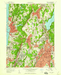
Editions of this 1957 White Plains Map
2 editions found
Other maps of this area

1891 · Harlem
USGS Topo · 1:62,500

1892 · Stamford
USGS Topo · 1:62,500

1892 · Tarrytown
USGS Topo · 1:62,500

1893 · Stamford
USGS Topo · 1:62,500

1893 · Tarrytown
USGS Topo · 1:62,500

1897 · Harlem
USGS Topo · 1:62,500

1897 · Oyster Bay
USGS Topo · 1:62,500

1898 · Harlem
USGS Topo · 1:62,500

1898 · Oyster Bay
USGS Topo · 1:62,500

1899 · Stamford
USGS Topo · 1:62,500