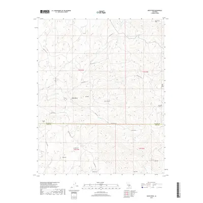
2018 Map of White River
USGS Topo · Published 2018About this map
White River sits at the foot of the western Sierra Nevada foothills, straddling the boundary where Tulare County and Kern County meet. This landscape is defined by its series of distinct peaks and gulches, creating a complex drainage network into the namesake White River. Tributaries such as Coho Cr and Chulaney Cr flow from higher elevations near King George Ridge and Rail Flat Ridge in the north toward the central valley floor. The map highlights numerous family-named and topographic landmarks, including Joe Bowen Canyon, Isham Hill, and Eclipse Hill, which offer valuable points of reference for local historians. This era of the territory is marked by a network of rural routes like White River Rd and Blue Mountain Rd that connect the small settlement of White River to the surrounding canyons and ridges.
Find a feature on this map
33 named features on this map. Tap any name to fly to it.
Don’t see what you’re looking for? This feature index may not catch every label — zoom into the map to look around manually.
Map Details
Editions of this 2018 White River Map
This is the sole edition of this map. No revisions or reprints were ever made.
Other maps of this area

1920 · Delonagha
USGS Topo · 1:62,500

1926 · Quincy School
USGS Topo · 1:31,680

1926 · Glennville
USGS Topo · 1:62,500

1929 · Quincy School
USGS Topo · 1:31,680

1932 · Woody
USGS Topo · 1:62,500

1935 · Woody
USGS Topo · 1:62,500

1936 · White River
USGS Topo · 1:62,500

1936 · Tobias Peak
USGS Topo · 1:125,000

1943 · Tobias Peak
USGS Topo · 1:125,000

1945 · Tobias Peak
USGS Topo · 1:62,500