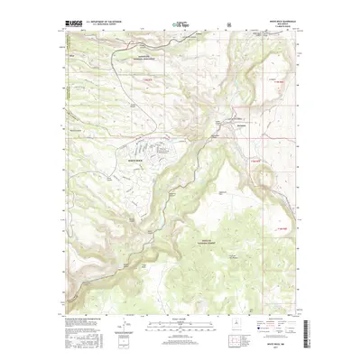
2017 Map of White Rock
USGS Topo · Published 2017About this map
White Rock serves as the residential anchor on this high plateau, showing a dense network of suburban streets such as Sherwood Blvd and Rover Blvd overlooking the dramatic transition to the Rio Grande valley. The map documents the intersection of modern settlement and ancient heritage, with the Tsankawi unit of Bandelier National Monument situated north of the community. The topography is defined by deep incisions like Pueblo Canyon and Los Alamos Canyon, which cut through the volcanic landscape toward the river.
Find a feature on this map
86 named features on this map. Tap any name to fly to it.
Don’t see what you’re looking for? This feature index may not catch every label — zoom into the map to look around manually.
Map Details
Editions of this 2017 White Rock Map
This is the sole edition of this map. No revisions or reprints were ever made.
Other maps of this area

1892 · Santa Clara
USGS Topo · 1:125,000

1951 · Agua Fria
USGS Topo · 1:24,000

1952 · White Rock
USGS Topo · 1:24,000

1952 · Frijoles
USGS Topo · 1:24,000

1952 · Puye
USGS Topo · 1:24,000

1952 · Montoso Peak
USGS Topo · 1:24,000

1952 · Guaje Mountain
USGS Topo · 1:24,000

1953 · Espanola
USGS Topo · 1:24,000

1953 · Cochiti Dam
USGS Topo · 1:24,000

1953 · Horcado Ranch
USGS Topo · 1:24,000