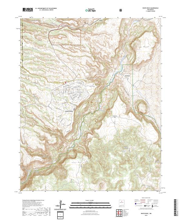
2023 Map of White Rock
USGS Topo · Published 2023About this map
The White Rock residential community dominates the plateau above the Rio Grande, showing a modern suburban street network including Longview Drive and Sherwood Boulevard positioned against the dramatic topography of White Rock Canyon. This high-desert landscape is defined by its deep incisions, where Mortandad Canyon, Pajarito Canyon, and Water Canyon drain toward the river. To the north, the boundary of Bandelier National Monument encompasses the upper reaches of Sandia Canyon and Los Alamos Canyon, preserving the archaeological and natural character of the Pajarito Plateau. Evidence of the region's ranching and hydraulic history appears in the distribution of water sources like Stoney Tank and Basalt Spring, while the former rail point at Buckman sits along the river's edge, marking an older layer of transport and settlement history.
Find a feature on this map
83 named features on this map. Tap any name to fly to it.
Don’t see what you’re looking for? This feature index may not catch every label — zoom into the map to look around manually.
Map Details
Editions of this 2023 White Rock Map
This is the sole edition of this map. No revisions or reprints were ever made.
Other maps of this area

1892 · Santa Clara
USGS Topo · 1:125,000

1951 · Agua Fria
USGS Topo · 1:24,000

1952 · White Rock
USGS Topo · 1:24,000

1952 · Frijoles
USGS Topo · 1:24,000

1952 · Puye
USGS Topo · 1:24,000

1952 · Montoso Peak
USGS Topo · 1:24,000

1952 · Guaje Mountain
USGS Topo · 1:24,000

1953 · Espanola
USGS Topo · 1:24,000

1953 · Cochiti Dam
USGS Topo · 1:24,000

1953 · Horcado Ranch
USGS Topo · 1:24,000