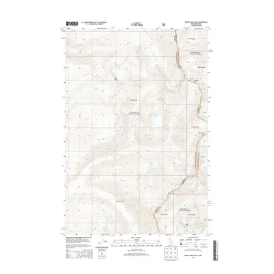
2013 Map of White Sand Lake
USGS Topo · Published 2013About this map
The Idaho-Montana border divides the high alpine wilderness of the Bitterroot National Forest and Clearwater National Forest in this 2013 survey. The landscape is defined by its dramatic hydrology, featuring a dense network of glacial basins and high-altitude water bodies including White Sand Lake, Maud Lake, and the expansive Big Creek Lakes. This area remains largely primitive, with movement dictated by geographic bottlenecks like Packbox Pass and Bear Creek Pass. Historical nomenclature is preserved in labels like Colt Killed Cr and Dan Ridge, reflecting the early exploration and naming of these high divides. The map provides a detailed view of the Idaho County and Ravalli County line as it follows the crest of the Bitterroot Mountains near Totem Peak, serving as a primary reference for the intricate terrain of the Selway-Bitterroot Wilderness area.
Find a feature on this map
47 named features on this map. Tap any name to fly to it.
Don’t see what you’re looking for? This feature index may not catch every label — zoom into the map to look around manually.
Map Details
Editions of this 2013 White Sand Lake Map
This is the sole edition of this map. No revisions or reprints were ever made.
Other maps of this area

1901 · Hamilton
USGS Topo · 1:125,000

1911 · Lolo
USGS Topo · 1:250,000

1912 · Missoula
USGS Topo · 1:125,000

1913 · Lolo
USGS Topo · 1:250,000

1956 · Hamilton
USGS Topo · 1:250,000

1959 · Hamilton
USGS Topo · 1:250,000

1960 · Hamilton
USGS Topo · 1:250,000

1964 · Hamilton
USGS Topo · 1:250,000

1964 · Roundtop
USGS Topo · 1:24,000

1964 · St. Joseph Peak
USGS Topo · 1:24,000