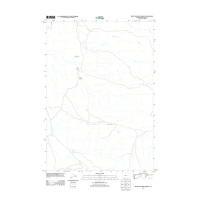
2012 Map of White Sulphur Spring
USGS Topo · Published 2012About this map
White Sulphur Spring and Split Ear Spring dot this arid landscape in Big Horn County, where intermittent water sources define the character of the terrain. The northern reaches are shaped by the dramatic drop of Devils Leap and the broad expanse of Red Basin, a geographic depression that funnels drainage toward the Bush Cr system. Local topography is deeply incised by the passage of seasonal flows, most notably within Webber Canyon. This 2012 survey by the U.S. Geological Survey shows a network of remote access routes, including Red Gulch Rd and the aptly named End Oil Rd, which trace the contours of the high desert. The drainage patterns of Trapper Cr and Dry Bush Cr illustrate the complex hydrology of this Wyoming basin where life and movement revolve around scarce water points.
Find a feature on this map
10 named features on this map. Tap any name to fly to it.
Don’t see what you’re looking for? This feature index may not catch every label — zoom into the map to look around manually.
Map Details
Editions of this 2012 White Sulphur Spring Map
This is the sole edition of this map. No revisions or reprints were ever made.
Other maps of this area

1898 · Bald Mountain
USGS Topo · 1:125,000

1901 · Bald Mountain
USGS Topo · 1:125,000

1955 · Sheridan
USGS Topo · 1:250,000

1958 · Sheridan
USGS Topo · 1:250,000

1960 · Shell Falls
USGS Topo · 1:24,000

1960 · White Sulphur Spring
USGS Topo · 1:24,000

1960 · Black Mountain
USGS Topo · 1:24,000

1960 · Flitner Reservoir
USGS Topo · 1:24,000

1960 · Hyatt Ranch
USGS Topo · 1:24,000

1960 · Manderson NE
USGS Topo · 1:24,000