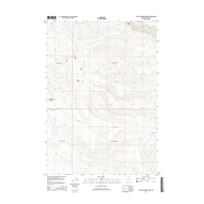
2015 Map of White Sulphur Spring
USGS Topo · Published 2015About this map
White Sulphur Spring and Split Ear Spring define the hydrological character of this Big Horn County landscape, where water sources are vital landmarks in an arid basin. The terrain is deeply sculpted by erosion, evidenced by dramatic features such as Devils Leap and the expansive Red Basin. Human access to this remote area is primarily facilitated by the Red Gulch / Alkali Nat'l Back Country Byway, a route that follows the natural contours of the land through Webber Canyon and near the headwaters of Trapper Cr. This 2015 survey illustrates how the modern road network, including Red Gulch Rd, overlays a complex system of seasonal drainages like East Fork McDermotts Gulch and Dry Bush Cr, which have shaped the region's ranching and travel history.
Find a feature on this map
17 named features on this map. Tap any name to fly to it.
Don’t see what you’re looking for? This feature index may not catch every label — zoom into the map to look around manually.
Map Details
Editions of this 2015 White Sulphur Spring Map
This is the sole edition of this map. No revisions or reprints were ever made.
Other maps of this area

1898 · Bald Mountain
USGS Topo · 1:125,000

1901 · Bald Mountain
USGS Topo · 1:125,000

1955 · Sheridan
USGS Topo · 1:250,000

1958 · Sheridan
USGS Topo · 1:250,000

1960 · Shell Falls
USGS Topo · 1:24,000

1960 · White Sulphur Spring
USGS Topo · 1:24,000

1960 · Black Mountain
USGS Topo · 1:24,000

1960 · Flitner Reservoir
USGS Topo · 1:24,000

1960 · Hyatt Ranch
USGS Topo · 1:24,000

1960 · Manderson NE
USGS Topo · 1:24,000