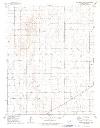
1976 Map of White Woman Bottoms
USGS Topo · Published 1978About this map
White Woman Bottoms and the broad expanses of Pleasant Valley dominate this mid-1970s landscape in Finney County. The area reflects a rural economy shaped by large-scale agricultural operations and resource extraction, evidenced by the presence of a feedlot and numerous gas wells. Irrigation and water management are critical infrastructure here, with the Farmers Ditch and a flume crossing the terrain to support the high-plains farming.
Find a feature on this map
11 named features on this map. Tap any name to fly to it.
Don’t see what you’re looking for? This feature index may not catch every label — zoom into the map to look around manually.
Map Details
Editions of this 1976 White Woman Bottoms Map
This is the sole edition of this map. No revisions or reprints were ever made.
Other maps of this area

1896 · Garden
USGS Topo · 1:125,000

1944 · Tennis
USGS Topo · 1:62,500

1955 · Dodge City
USGS Topo · 1:250,000

1955 · Scott City
USGS Topo · 1:250,000

1958 · Dodge City
USGS Topo · 1:250,000

1958 · Scott City
USGS Topo · 1:250,000

1959 · Dodge City
USGS Topo · 1:250,000

1960 · Garden City East
USGS Topo · 1:24,000
1960 · Garden City West
USGS Topo · 1:24,000

1967 · Pierceville
USGS Topo · 1:24,000