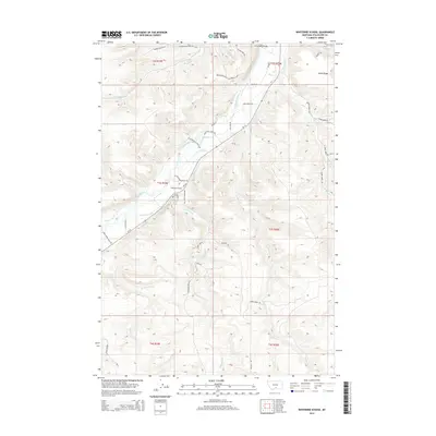
2014 Map of Whitebird School
USGS Topo · Published 2014About this map
Whitebird School stands as a focal point in this Stillwater County landscape, situated where the valley floor meets the rising elevations of Shane Ridge. The Stillwater River dictates the local geography, winding past Firemans Point and supporting a network of agricultural waterworks including the Whitebird Ditch, Shane Ditch, and Scott Ditch. These irrigation features illustrate the region's reliance on river management for ranching and farming in the early 21st century.
Find a feature on this map
48 named features on this map. Tap any name to fly to it.
Don’t see what you’re looking for? This feature index may not catch every label — zoom into the map to look around manually.
Map Details
Editions of this 2014 Whitebird School Map
This is the sole edition of this map. No revisions or reprints were ever made.
Other maps of this area

1892 · Stillwater
USGS Topo · 1:125,000

1932 · Red Lodge No 2
USGS Topo · 1:48,000

1932 · Red Lodge No 1
USGS Topo · 1:48,000

1954 · Billings
USGS Topo · 1:250,000

1955 · Springtime
USGS Topo · 1:24,000

1955 · Whitebird School
USGS Topo · 1:24,000

1955 · Absarokee
USGS Topo · 1:24,000

1956 · Columbus West
USGS Topo · 1:24,000

1956 · Shane Ridge
USGS Topo · 1:24,000

1956 · Roscoe NW
USGS Topo · 1:24,000