
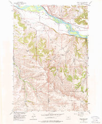
1956 Map of Shane Ridge
USGS Topo · Published 1957About this map
The Yellowstone River cuts a wide path across the northern reaches of this mid-century survey, creating a fertile alluvial plain known as Flaherty Flat. This low-lying agricultural landscape is defined by irrigation infrastructure like Shane Ditch and Cove Ditch, which parallel the tracks of the Northern Pacific railroad. The transition from the river valley to the uplands is marked by the dramatic rise of Countrymans Bluff, leading into the higher elevations of Shane Ridge.
Find a feature on this map
21 named features on this map. Tap any name to fly to it.
Don’t see what you’re looking for? This feature index may not catch every label — zoom into the map to look around manually.
Map Details
Editions of this 1956 Shane Ridge Map
2 editions found
Other maps of this area

1892 · Stillwater
USGS Topo · 1:125,000

1932 · Red Lodge No 2
USGS Topo · 1:48,000

1932 · Red Lodge No 1
USGS Topo · 1:48,000

1954 · Billings
USGS Topo · 1:250,000

1955 · Whitebird School
USGS Topo · 1:24,000

1956 · Columbus West
USGS Topo · 1:24,000

1956 · Horse Butte
USGS Topo · 1:24,000

1956 · Columbus East
USGS Topo · 1:24,000

1956 · Roscoe NE
USGS Topo · 1:24,000

1956 · Rapids
USGS Topo · 1:24,000