
1956 Map of Columbus East
USGS Topo · Published 1957About this map
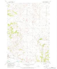
Columbus serves as the focal point for this mid-1950s survey of the Stillwater Valley, positioned along the northern bank of the Yellowstone River. The landscape is defined by the vital infrastructure of the era, including the Northern Pacific railroad corridor and the extensive Columbus Water Users Association Ditch, which follows the river's contours to support local agriculture. The map captures the town's early aviation facilities at the Landing Field and traces the intricate network of drainage systems like Keyser Creek and Horse Creek that carve through the rising benchlands. A solitary Grave noted south of the main settlement provides a specific point of interest for genealogists, while high points like VABM Herder 4698 offer a perspective on the terrain's elevation changes north of the river valley.
Find a feature on this map
17 named features on this map. Tap any name to fly to it.
Don’t see what you’re looking for? This feature index may not catch every label — zoom into the map to look around manually.
Map Details
Editions of this 1956 Columbus East Map
2 editions found
Other maps of this area

1892 · Stillwater
USGS Topo · 1:125,000

1954 · Billings
USGS Topo · 1:250,000

1955 · Whitebird School
USGS Topo · 1:24,000

1956 · Columbus West
USGS Topo · 1:24,000

1956 · Hunter Lake
USGS Topo · 1:24,000

1956 · Shane Ridge
USGS Topo · 1:24,000

1956 · Horse Butte
USGS Topo · 1:24,000

1956 · Lindemulder Hill
USGS Topo · 1:24,000

1956 · Rapids
USGS Topo · 1:24,000
1956 · Wheat Basin SW
USGS Topo · 1:24,000