
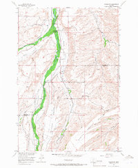
1956 Map of Roscoe NW
USGS Topo · Published 1957About this map
Agricultural water rights define the landscape of south-central Montana in this mid-century survey of the Stillwater and Carbon county line. The drainage of West Rosebud Creek and East Rosebud Creek is extensively managed by a complex network of named irrigation works, including the Sylvester Ditch, Woodard Ditch, and the Rosebud Ditch Co. These features reveal a history of family-led land development, evidenced by labels like the Espeland-Ostrum-George Ditch and the Kyle-Ferster Seely Ditch.
Find a feature on this map
35 named features on this map. Tap any name to fly to it.
Don’t see what you’re looking for? This feature index may not catch every label — zoom into the map to look around manually.
Map Details
Editions of this 1956 Roscoe NW Map
2 editions found
Other maps of this area

1891 · Big Timber
USGS Topo · 1:125,000

1892 · Stillwater
USGS Topo · 1:125,000

1893 · Big Timber
USGS Topo · 1:125,000

1898 · Granite Mountain District
USGS Topo · 1:125,000

1932 · Red Lodge No 2
USGS Topo · 1:48,000

1932 · Nye No 1
USGS Topo · 1:48,000

1954 · Billings
USGS Topo · 1:250,000

1955 · Sandborn Creek
USGS Topo · 1:24,000

1955 · Whitebird School
USGS Topo · 1:24,000

1955 · Absarokee
USGS Topo · 1:24,000