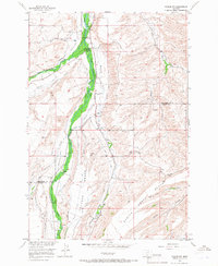
1956 Map of Roscoe NW
USGS Topo · Published 1966About this map
Rosebud Creek and its tributaries carve through the Montana landscape at the Stillwater and Carbon County line, defining a region of high benches and deep water-carved valleys. The 1956 field check reveals a community anchored by the Rosebud Community Center and the Reverend Madison Historical Monument, located near the confluence where West Rosebud Creek joins the main flow. The topography is dominated by broad plateaus like Coleman Bench and rising features such as Yancey Hill, while the valley floors are marked by essential water management infrastructure, including a Siphon, Flume, and Gaging Sta. This map details a ranching and rural landscape where local landmarks like Smith Bridge and several unnamed cemeteries provide critical points of reference for genealogists and local historians studying the mid-century settlement patterns of the Beartooth foothills.
Find a feature on this map
23 named features on this map. Tap any name to fly to it.
Don’t see what you’re looking for? This feature index may not catch every label — zoom into the map to look around manually.
Map Details
Editions of this 1956 Roscoe NW Map
2 editions found

Other maps of this area

1891 · Big Timber
USGS Topo · 1:125,000

1892 · Stillwater
USGS Topo · 1:125,000

1893 · Big Timber
USGS Topo · 1:125,000

1898 · Granite Mountain District
USGS Topo · 1:125,000

1932 · Red Lodge No 2
USGS Topo · 1:48,000

1932 · Nye No 1
USGS Topo · 1:48,000

1954 · Billings
USGS Topo · 1:250,000

1955 · Sandborn Creek
USGS Topo · 1:24,000

1955 · Whitebird School
USGS Topo · 1:24,000

1955 · Absarokee
USGS Topo · 1:24,000