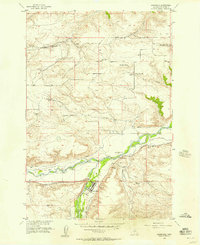
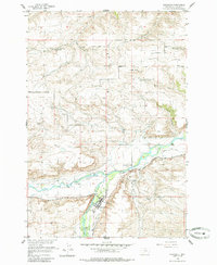
1955 Map of Absarokee
USGS Topo · Published 1957About this map
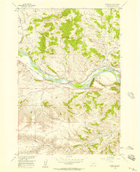
The Stillwater River valley serves as the central artery for this mid-century survey of the Absarokee region. The settlement pattern is defined by a sophisticated network of irrigation canals, including the Garrigus Ditch, Nichols Ditch, and the Sylvester Easly Ditch, which redirect water to the surrounding benchlands. These engineering features underscore the agricultural dependency of the Stillwater and Beaver Creek drainages during this era.
Find a feature on this map
21 named features on this map. Tap any name to fly to it.
Don’t see what you’re looking for? This feature index may not catch every label — zoom into the map to look around manually.
Map Details
Editions of this 1955 Absarokee Map
2 editions found
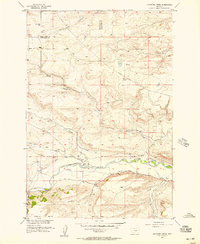
Other maps of this area

1891 · Big Timber
USGS Topo · 1:125,000

1892 · Stillwater
USGS Topo · 1:125,000

1893 · Big Timber
USGS Topo · 1:125,000

1898 · Granite Mountain District
USGS Topo · 1:125,000

1932 · Red Lodge No 2
USGS Topo · 1:48,000

1932 · Nye No 1
USGS Topo · 1:48,000

1954 · Billings
USGS Topo · 1:250,000
1955 · Sandborn Creek
USGS Topo · 1:24,000
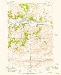
1955 · Reed Point
USGS Topo · 1:24,000
1955 · Springtime
USGS Topo · 1:24,000