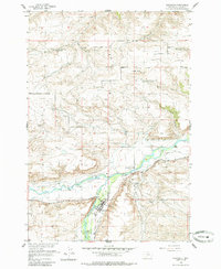
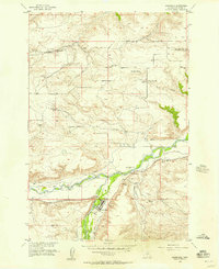
1955 Map of Absarokee
USGS Topo · Published 1985About this map
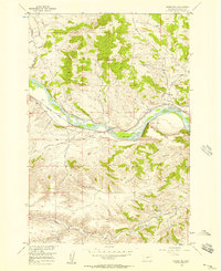
The Stillwater River and Rosebud Creek converge at the settlement of Absarokee, forming a landscape defined by its intricate water management systems. In the mid-1950s, the local economy relied heavily on a complex network of irrigation channels, including the Mendenhall Ditch, Sylvester Beasley Ditch, and Town Ditch, which redirect water through the valley floor. Educational hubs are distributed across the rural terrain, with Mountainview Sch, Huntley Butte Sch, and Beaver Creek Sch serving the surrounding ranching and farming communities. The presence of the Albert Johnson Bridge and the Riverside Inn near the riverbanks highlights the importance of these waterways for both transit and commerce. Rising above the lowlands, Huntley Butte provides a significant vertical landmark in a region otherwise dominated by the serpentine paths of the river and its many supporting coulees and creeks.
Find a feature on this map
30 named features on this map. Tap any name to fly to it.
Don’t see what you’re looking for? This feature index may not catch every label — zoom into the map to look around manually.
Map Details
Editions of this 1955 Absarokee Map
2 editions found
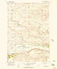
Other maps of this area

1891 · Big Timber
USGS Topo · 1:125,000

1892 · Stillwater
USGS Topo · 1:125,000

1893 · Big Timber
USGS Topo · 1:125,000

1898 · Granite Mountain District
USGS Topo · 1:125,000

1932 · Red Lodge No 2
USGS Topo · 1:48,000

1932 · Nye No 1
USGS Topo · 1:48,000

1954 · Billings
USGS Topo · 1:250,000
1955 · Sandborn Creek
USGS Topo · 1:24,000
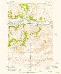
1955 · Reed Point
USGS Topo · 1:24,000
1955 · Springtime
USGS Topo · 1:24,000