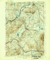
1938 Map of Whitefield
USGS Topo · Published 1938About this map
The Connecticut River serves as the dividing line between New Hampshire and Vermont in this late 1930s landscape, where the town of Lunenburg sits across the water from Lancaster. This era shows a complex rail network at its peak, with the Maine Central RR, Boston and Maine RR, and Canadian National Ry all intersecting near Quebec Junction. These rail corridors were vital for the local economy, connecting timber and agricultural hubs like Whitefield and Bethlehem to broader markets.
Find a feature on this map
109 named features on this map. Tap any name to fly to it.
Don’t see what you’re looking for? This feature index may not catch every label — zoom into the map to look around manually.
Map Details
Editions of this 1938 Whitefield Map
3 editions found

Other maps of this area

1893 · Mt. Washington
USGS Topo · 1:62,500

1895 · Crawford Notch
USGS Topo · 1:62,500

1896 · Mt. Washington
USGS Topo · 1:62,500

1896 · Crawford Notch
USGS Topo · 1:62,500

1900 · Whitefield
USGS Topo · 1:62,500

1920 · Guildhall
USGS Topo · 1:62,500

1929 · Moosilauke
USGS Topo · 1:62,500

1929 · Franconia
USGS Topo · 1:62,500

1930 · Percy
USGS Topo · 1:62,500

1931 · Guildhall
USGS Topo · 1:48,000