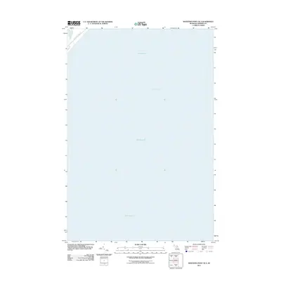
2011 Map of Whitefish Point OE S
USGS Topo · Published 2011About this map
Lake Superior dominates this nautical landscape off the coast of Michigan’s Upper Peninsula. Centered on the open waters where the lake meets Whitefish Bay, the map captures a critical maritime corridor leading toward the St. Marys River. The terrestrial portion is limited to the northwestern corner, defined by the path of N Whitefish Point Rd. This 2011 survey reflects the contemporary shoreline and bathymetric extent of the region, providing a clear view of the deep-water approaches to the historic point. Given the lack of inland development, the focus remains entirely on the coastal interface and the expansive aquatic geography of the Great Lakes.
Find a feature on this map
3 named features on this map. Tap any name to fly to it.
Don’t see what you’re looking for? This feature index may not catch every label — zoom into the map to look around manually.
Map Details
Editions of this 2011 Whitefish Point OE S Map
This is the sole edition of this map. No revisions or reprints were ever made.
Other maps of this area

1951 · Vermilion SE
USGS Topo · 1:24,000

1951 · Shelldrake
USGS Topo · 1:24,000

1951 · Emerson
USGS Topo · 1:24,000

1951 · Whitefish Point
USGS Topo · 1:24,000

1951 · Shelldrake
USGS Topo · 1:62,500

1954 · Sault Sainte Marie
USGS Topo · 1:250,000

1956 · Sault Sainte Marie
USGS Topo · 1:250,000

1957 · Sault Sainte Marie
USGS Topo · 1:250,000

1958 · Sault Sainte Marie
USGS Topo · 1:250,000
1985 · Two Hearted River
USGS Topo · 1:100,000