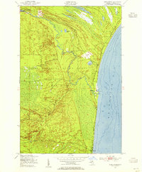
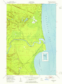
1951 Map of Shelldrake
USGS Topo · Published 1955About this map
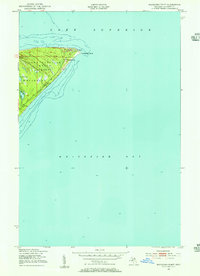
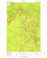
Whitefish Bay defines the eastern edge of this Michigan landscape, where the cold waters meet a shoreline dotted with small coastal settlements during the early 1950s. The village of Shelldrake sits at the mouth of the Betsy River, appearing here as a quiet outpost along the winding watercourse that drains the interior wetlands. Further south, the community of Paradise anchors the lower coast, connected by the narrow corridor of Whitefish Road. Much of the interior is dedicated to the Lake Superior State Forest, a terrain characterized by dense marshland and numerous small bodies of water like Warners Lake, Hawkins Lake, and the sprawling Marsh Lake. The presence of features like The Widewaters and the meandering Dead Creek illustrates a complex hydrologic network essential to the region's historical timber and fishing industries.
Find a feature on this map
13 named features on this map. Tap any name to fly to it.
Don’t see what you’re looking for? This feature index may not catch every label — zoom into the map to look around manually.
Map Details
Editions of this 1951 Shelldrake Map
2 editions found

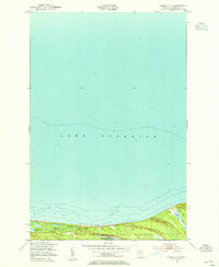
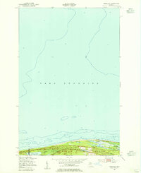
Other maps of this area
1951 · Vermilion SE
USGS Topo · 1:24,000
1951 · Vermilion
USGS Topo · 1:24,000
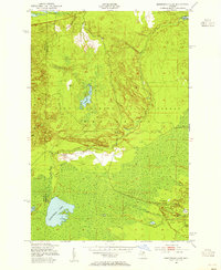
1951 · Sheephead Lake
USGS Topo · 1:24,000
1951 · Emerson
USGS Topo · 1:24,000
1951 · Whitefish Point
USGS Topo · 1:24,000
1951 · Timberlost
USGS Topo · 1:24,000

1951 · Shelldrake
USGS Topo · 1:62,500

1954 · Sault Sainte Marie
USGS Topo · 1:250,000

1956 · Sault Sainte Marie
USGS Topo · 1:250,000

1957 · Sault Sainte Marie
USGS Topo · 1:250,000