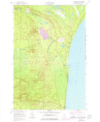
1951 Map of Shelldrake
USGS Topo · Published 1977About this map
Whitefish Bay defines the eastern edge of this coastal survey, where the Betsy River snakes through the marshy lowlands of the Lake Superior State Forest. The map documents a period of transition in northern Chippewa County, capturing the small settlement at Shelldrake and the growing community of Paradise near the southern boundary. These outposts were connected primarily by Whitefish Road, which hugs the shoreline. Inland, the landscape is dominated by a complex network of wetlands and small water bodies such as The Widewaters, McMullan Lakes, and Hawkins Lake. The presence of Dead Creek and the South Branch feeding into the main river systems illustrates the intricate drainage patterns of this Upper Peninsula wilderness during the mid-20th century.
Find a feature on this map
15 named features on this map. Tap any name to fly to it.
Don’t see what you’re looking for? This feature index may not catch every label — zoom into the map to look around manually.
Map Details
Editions of this 1951 Shelldrake Map
2 editions found
Other maps of this area

1951 · Vermilion SE
USGS Topo · 1:24,000

1951 · Shelldrake
USGS Topo · 1:24,000

1951 · Vermilion
USGS Topo · 1:24,000

1951 · Sheephead Lake
USGS Topo · 1:24,000

1951 · Emerson
USGS Topo · 1:24,000

1951 · Whitefish Point
USGS Topo · 1:24,000

1951 · Timberlost
USGS Topo · 1:24,000

1951 · Shelldrake
USGS Topo · 1:62,500

1954 · Sault Sainte Marie
USGS Topo · 1:250,000

1956 · Sault Sainte Marie
USGS Topo · 1:250,000