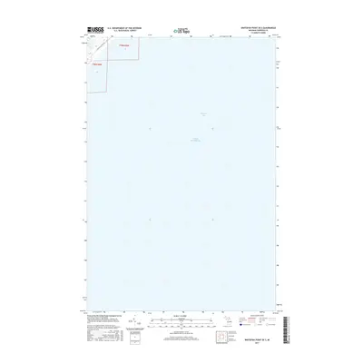
2017 Map of Whitefish Point OE S
USGS Topo · Published 2017About this map
Lake Superior dominates this nautical landscape, where the waters of Whitefish Bay meet the shoreline of Michigan's Upper Peninsula. The map focuses primarily on the maritime expanse, providing a precise record of the shoreline geometry just south of the point during the late 2010s. On the small portion of land captured in the northwest corner, N Whitefish Point Rd serves as the primary corridor for land travel, following the coast. This chart is a specific resource for understanding the physical boundaries between land and lake, showing the intersection of t50n r5w and t50n r6w within the context of the region's broader public land survey system.
Find a feature on this map
5 named features on this map. Tap any name to fly to it.
Don’t see what you’re looking for? This feature index may not catch every label — zoom into the map to look around manually.
Map Details
Editions of this 2017 Whitefish Point OE S Map
This is the sole edition of this map. No revisions or reprints were ever made.
Other maps of this area

1951 · Vermilion SE
USGS Topo · 1:24,000

1951 · Shelldrake
USGS Topo · 1:24,000

1951 · Emerson
USGS Topo · 1:24,000

1951 · Whitefish Point
USGS Topo · 1:24,000

1951 · Shelldrake
USGS Topo · 1:62,500

1954 · Sault Sainte Marie
USGS Topo · 1:250,000

1956 · Sault Sainte Marie
USGS Topo · 1:250,000

1957 · Sault Sainte Marie
USGS Topo · 1:250,000

1958 · Sault Sainte Marie
USGS Topo · 1:250,000
1985 · Two Hearted River
USGS Topo · 1:100,000