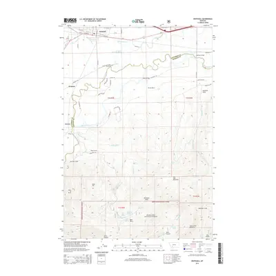
2014 Map of Whitehall
USGS Topo · Published 2014About this map
Whitehall serves as the primary hub in this Jefferson County landscape, situated at the junction of MT-2 and MT-55 just north of the Jefferson River. The topography transitions from the agricultural river valley and its complex irrigation network, including the Pleasant Valley Ditch and Jefferson Slough, to the high elevations of the Deerlodge National Forest. To the south and east, the terrain rises sharply into the Dry Lake Mountains and the northern reaches of the Tobacco Root Mountains. Smaller settlements like Piedmont and Renova are situated along the valley floor, connected by historic routes like Pacific Railroad Rd and the Lewis and Clark Trl. Geologic and water features are abundant, from the Splan Springs and Bone Basin Spring in the central hills to the distinct landforms of Parrot Bench and the Point of Rocks, which overlook the winding river corridor.
Find a feature on this map
64 named features on this map. Tap any name to fly to it.
Don’t see what you’re looking for? This feature index may not catch every label — zoom into the map to look around manually.
Map Details
Editions of this 2014 Whitehall Map
This is the sole edition of this map. No revisions or reprints were ever made.
Other maps of this area

1888 · Three Forks
USGS Topo · 1:250,000

1893 · Dillon
USGS Topo · 1:250,000

1894 · Three Forks
USGS Topo · 1:250,000

1895 · Three Forks
USGS Topo · 1:250,000

1947 · Bozeman
USGS Topo · 1:250,000

1948 · Bozeman
USGS Topo · 1:250,000

1950 · Jefferson Island
USGS Topo · 1:62,500

1950 · Harrison
USGS Topo · 1:62,500

1955 · Bozeman
USGS Topo · 1:250,000

1955 · Dillon
USGS Topo · 1:250,000
Featured Places
- Whitehall, MT
- Rice Motel and Trailer Court, Whitehall
- La Casa Trailer Park, Whitehall
- Jefferson County, MT
- Madison County, MT