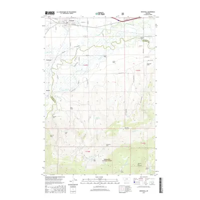
2017 Map of Whitehall
USGS Topo · Published 2017About this map
Whitehall serves as a northern hub where the Jefferson River begins to carve through the landscape of the Deerlodge National Forest. The map shows a transition from the agricultural flats of the valley, marked by irrigation features like the Parrot Ditch Rd and Pleasant Valley Ditch, into the high elevations of the Dry Lake Mountains and Tobacco Root Spring. This 2017 edition details the intricate water systems of the region, from the Piedmont Swamp to the Jefferson Slough, which define the ranching and natural boundaries between Piedmont and Renova. Significant elevation changes are marked by named landmarks such as Gold Hill and Parrot Bench, while crossings like Mayflower Bridge and Kountz Bridge establish the primary connection points across the water. The southern portion of the quadrangle is largely defined by the rugged drainage basins of Whestphal Basin and Bone Basin.
Find a feature on this map
78 named features on this map. Tap any name to fly to it.
Don’t see what you’re looking for? This feature index may not catch every label — zoom into the map to look around manually.
Map Details
Editions of this 2017 Whitehall Map
This is the sole edition of this map. No revisions or reprints were ever made.
Other maps of this area

1888 · Three Forks
USGS Topo · 1:250,000

1893 · Dillon
USGS Topo · 1:250,000

1894 · Three Forks
USGS Topo · 1:250,000

1895 · Three Forks
USGS Topo · 1:250,000

1947 · Bozeman
USGS Topo · 1:250,000

1948 · Bozeman
USGS Topo · 1:250,000

1950 · Jefferson Island
USGS Topo · 1:62,500

1950 · Harrison
USGS Topo · 1:62,500

1955 · Bozeman
USGS Topo · 1:250,000

1955 · Dillon
USGS Topo · 1:250,000
Featured Places
- Whitehall, MT
- Rice Motel and Trailer Court, Whitehall
- La Casa Trailer Park, Whitehall
- Jefferson County, MT
- Madison County, MT