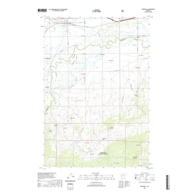
2020 Map of Whitehall
USGS Topo · Published 2020About this map
Whitehall serves as the primary hub in this Jefferson County landscape, where the Jefferson River and Jefferson Slough carve a complex path through the valley floor. The map illustrates a transition from the agricultural lowlands of Parrot Bench to the high elevations of the Tobacco Root Mountains and Dry Lake Mountains. This 2020 survey details the infrastructure of the region, from the Mayflower Bridge to the remote New Mayflower Mine tucked into the southern hills. Local history and genealogy interest is concentrated around the smaller settlements of Piedmont and Renova, as well as the numerous named water sources like Upper Gooseberry Spring and Bone Basin Spring within the Deerlodge National Forest. The presence of the Parrot Ditch Rd and Pleasant Valley Ditch underscores the vital role of irrigation in sustaining the valley's development.
Find a feature on this map
76 named features on this map. Tap any name to fly to it.
Don’t see what you’re looking for? This feature index may not catch every label — zoom into the map to look around manually.
Map Details
Editions of this 2020 Whitehall Map
This is the sole edition of this map. No revisions or reprints were ever made.
Other maps of this area

1888 · Three Forks
USGS Topo · 1:250,000

1893 · Dillon
USGS Topo · 1:250,000

1894 · Three Forks
USGS Topo · 1:250,000

1895 · Three Forks
USGS Topo · 1:250,000

1947 · Bozeman
USGS Topo · 1:250,000

1948 · Bozeman
USGS Topo · 1:250,000

1950 · Jefferson Island
USGS Topo · 1:62,500

1950 · Harrison
USGS Topo · 1:62,500

1955 · Bozeman
USGS Topo · 1:250,000

1955 · Dillon
USGS Topo · 1:250,000
Featured Places
- Whitehall, MT
- Rice Motel and Trailer Court, Whitehall
- La Casa Trailer Park, Whitehall
- Jefferson County, MT
- Madison County, MT