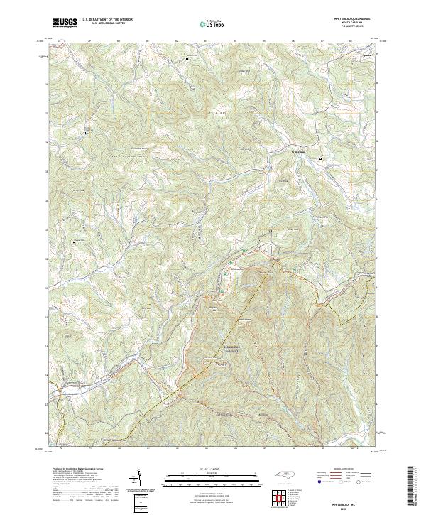
2022 Map of Whitehead
USGS Topo · Published 2022About this map
Whitehead and the southwestern outskirts of Sparta define the human footprint on this high-elevation landscape where Alleghany, Ashe, and Wilkes counties meet. The topography is dominated by prominent massifs like Peach Bottom Mtn and Fender Mtn, while the Blue Ridge Parkway winds across the southern ridges. This modern survey illustrates the enduring nature of early Appalachian settlements, marking family-connected sites such as Antioch Cem, Prathers Creek Cem, and Stamper Cem. Long-distance footpaths including the Mountains to Sea Trl and the MTS-Bluff Mtn Trl traverse the steep drainage basins of the Little River and Piney Fork. Distinctive geological formations like Alligator Back, Wildcat Rock, and the Fodder Stack provide clear landmarks for those tracing the historical routes through Air Bellows Gap and Horse Gap.
Find a feature on this map
141 named features on this map. Tap any name to fly to it.
Don’t see what you’re looking for? This feature index may not catch every label — zoom into the map to look around manually.
Map Details
Editions of this 2022 Whitehead Map
This is the sole edition of this map. No revisions or reprints were ever made.
Other maps of this area

1889 · Wytheville
USGS Topo · 1:125,000

1889 · Wilkesboro
USGS Topo · 1:125,000

1891 · Wilkesboro
USGS Topo · 1:125,000

1892 · Wytheville
USGS Topo · 1:125,000

1930 · Independence
USGS Topo · 1:48,000

1933 · Independence
USGS Topo · 1:62,500

1935 · Mouth of Wilson
USGS Topo · 1:48,000

1940 · Mouth of Wilson
USGS Topo · 1:62,500

1953 · Winston-Salem
USGS Topo · 1:250,000

1955 · Winston-Salem
USGS Topo · 1:250,000