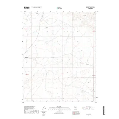
2020 Map of Whitehorse
USGS Topo · Published 2020About this map
Whitehorse serves as a focal point for this high-desert region of the Eastern Navajo Agency, where the landscape is defined by massive plateau formations and dry drainage systems. The northern edge of the map is dominated by the sprawling heights of W Chaco Mesa and Chaco Mesa, which overlook the winding course of the Fajada Wash. These landforms dictate the local infrastructure, with routes like Navajo Svc Rte 7004 and E Rte 9 skirting the base of the cliffs to connect remote points across the territory.
Find a feature on this map
17 named features on this map. Tap any name to fly to it.
Don’t see what you’re looking for? This feature index may not catch every label — zoom into the map to look around manually.
Map Details
Editions of this 2020 Whitehorse Map
This is the sole edition of this map. No revisions or reprints were ever made.
Other maps of this area

1883 · Mt. Taylor
USGS Topo · 1:250,000

1886 · Mt. Taylor
USGS Topo · 1:250,000

1892 · Mt. Taylor
USGS Topo · 1:250,000

1899 · Mt. Taylor
USGS Topo · 1:250,000

1958 · Albuquerque
USGS Topo · 1:250,000

1960 · Pueblo Alto Trading Post
USGS Topo · 1:24,000

1961 · Whitehorse Rincon
USGS Topo · 1:24,000

1961 · Whitehorse
USGS Topo · 1:24,000

1961 · Hospah
USGS Topo · 1:24,000
1961 · Mesita Americana
USGS Topo · 1:24,000
Featured Places
- Eastern Navajo Agency, NM
- Whitehorse, Eastern Navajo Agency
- McKinley County, NM
- United States
- New Mexico