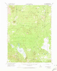
1962 Map of Whitehorse
USGS Topo · Published 1973About this map
Volcanic landforms and timber industry infrastructure dominate this landscape at the intersection of the Modoc National Forest and Shasta National Forest. The map reveals a complex network of industrial transport, specifically the Great Northern Scarface Logging Road and various routes like the Loveness Road, which serviced the region's logging operations. Settlement is sparse, represented by small outposts such as Whitehorse, Hollenbeck, and Long Bell Station, alongside specialized sites like the McArthur Cow Camp and Old Baker Cabin.
Find a feature on this map
64 named features on this map. Tap any name to fly to it.
Don’t see what you’re looking for? This feature index may not catch every label — zoom into the map to look around manually.
Map Details
Editions of this 1962 Whitehorse Map
2 editions found

Other maps of this area

1886 · Modoc Lava Bed
USGS Topo · 1:250,000

1892 · Modoc Lava-Bed
USGS Topo · 1:250,000

1932 · Bartle
USGS Topo · 1:96,000

1939 · Bartle
USGS Topo · 1:125,000

1952 · Timber Mountain
USGS Topo · 1:62,500

1952 · Hackamore
USGS Topo · 1:62,500

1952 · Medicine Lake
USGS Topo · 1:62,500

1954 · Alturas
USGS Topo · 1:250,000

1958 · Alturas
USGS Topo · 1:250,000

1961 · Hambone
USGS Topo · 1:62,500