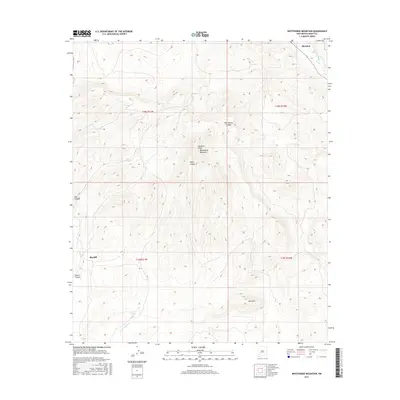
2017 Map of Whitehorse Mountain
USGS Topo · Published 2017About this map
Sherman anchors the northeastern corner of this Grant County landscape, situated where the Mimbres River flows through the high country. The terrain is defined by significant elevations and drainage systems, including Mimbres Peak, Whitehorse Mountain, and Blue Mtn. The naming conventions found on the map, such as Tom Brown Canyon and Negro Canyon, reflect a history of local land usage and family associations. Water management in this arid environment is evident through the placement of Seneca Tanks and Clark Tanks, which supported ranching or transit through the rugged interior. Further south, the label for Big Mill suggests a site of former industrial or agricultural activity near the head of Seneca Canyon. This 2017 survey details the complex network of canyons and peaks that have historically shaped the settlement patterns and resource extraction in the region.
Find a feature on this map
17 named features on this map. Tap any name to fly to it.
Don’t see what you’re looking for? This feature index may not catch every label — zoom into the map to look around manually.
Map Details
Editions of this 2017 Whitehorse Mountain Map
This is the sole edition of this map. No revisions or reprints were ever made.
Other maps of this area

1909 · Silver City
USGS Topo · 1:125,000

1937 · Santa Rita
USGS Topo · 1:24,000

1947 · Faywood Station
USGS Topo · 1:24,000

1948 · Santa Rita
USGS Topo · 1:24,000

1948 · Hurley East
USGS Topo · 1:24,000

1949 · Hurley East
USGS Topo · 1:24,000

1949 · Faywood Station
USGS Topo · 1:24,000
1951 · Santa Rita
USGS Topo · 1:24,000

1954 · Silver City
USGS Topo · 1:250,000

1955 · Las Cruces
USGS Topo · 1:250,000