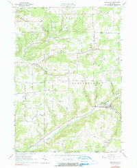
1965 Map of Whitesville
USGS Topo · Published 1990About this map
Whitesville and Spring Mills serve as the primary hubs in this mid-1960s survey of the New York-Pennsylvania border. The landscape is heavily marked by energy extraction, with a large Gas Field and Oil Field dominating the uplands of Independence and Willing. This industrial footprint is balanced by a dense network of family-named roads and rural infrastructure, including the Old Railroad Grade that follows the course of Cryder Creek toward Paynesville.
Find a feature on this map
75 named features on this map. Tap any name to fly to it.
Don’t see what you’re looking for? This feature index may not catch every label — zoom into the map to look around manually.
Map Details
Editions of this 1965 Whitesville Map
2 editions found
Other maps of this area

1899 · Gaines
USGS Topo · 1:62,500

1900 · Gaines
USGS Topo · 1:62,500

1926 · Wellsville
USGS Topo · 1:62,500

1926 · Greenwood
USGS Topo · 1:62,500

1932 · Genesee
USGS Topo · 1:62,500

1937 · Genesee
USGS Topo · 1:62,500

1950 · Elmira
USGS Topo · 1:250,000

1954 · Williamsport
USGS Topo · 1:250,000
1957 · Harrison Valley
USGS Topo · 1:24,000

1958 · Elmira
USGS Topo · 1:250,000