
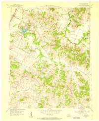
1953 Map of Whitesville
USGS Topo · Published 1955About this map
Whitesville serves as the primary hub in this mid-century portrait of the Kentucky coal and oil country where Daviess, Hancock, and Ohio counties meet. The landscape is defined by the winding course of the North Fork Panther Creek and its tributaries, which cut through a terrain heavily dotted with Oil Wells. This energy extraction economy is physically tethered to the Illinois Central railroad, which runs diagonally through the quadrangle, passing through smaller rail stops and settlements like Reynolds Sta and Deaneville.
Find a feature on this map
36 named features on this map. Tap any name to fly to it.
Don’t see what you’re looking for? This feature index may not catch every label — zoom into the map to look around manually.
Map Details
Editions of this 1953 Whitesville Map
This is the sole edition of this map. No revisions or reprints were ever made.
Other maps of this area

1903 · Tell City
USGS Topo · 1:62,500

1907 · Whitesville
USGS Topo · 1:62,500

1909 · Whitesville
USGS Topo · 1:62,500

1932 · Fordsville
USGS Topo · 1:62,500

1934 · Cannelton
USGS Topo · 1:62,500

1953 · Philpot
USGS Topo · 1:24,000

1953 · Dundee
USGS Topo · 1:24,000

1953 · Cloverport
USGS Topo · 1:24,000

1953 · Pleasant Ridge
USGS Topo · 1:24,000
1953 · Maceo
USGS Topo · 1:24,000