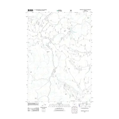
2011 Map of Whitetail Butte
USGS Topo · Published 2011About this map
Bull Prairie Lake and its associated Bull Prairie Dam serve as a central geographic anchor for this high-country region of Wheeler County. The landscape is defined by its numerous springs and mountain basins, indicating a reliance on seasonal water sources for grazing and timber operations. Notable points such as Whitetail Butte and Tamarack Mountain rise above the surrounding terrain, while the extensive drainage of Kahler Creek and Dead Horse Creek carves through the volcanic plateaus. For those tracing local history, the Haystack Cemetery located near Haystack Creek provides a tangible link to early families in the area. Forest access roads like Bull Prairie Rd and Happy Jack Rd connect these remote landmarks, which include high-altitude flats like Wilson Prairie and Rocky Flat.
Find a feature on this map
29 named features on this map. Tap any name to fly to it.
Don’t see what you’re looking for? This feature index may not catch every label — zoom into the map to look around manually.
Map Details
Editions of this 2011 Whitetail Butte Map
This is the sole edition of this map. No revisions or reprints were ever made.
Other maps of this area

1953 · Kimberly
USGS Topo · 1:62,500

1953 · Spray
USGS Topo · 1:62,500

1953 · Pendleton
USGS Topo · 1:250,000

1955 · Canyon City
USGS Topo · 1:250,000

1956 · Pendleton
USGS Topo · 1:250,000

1959 · Canyon City
USGS Topo · 1:250,000

1969 · Lefevre Prairie
USGS Topo · 1:24,000

1969 · Chapin Creek
USGS Topo · 1:24,000

1969 · Big Rock Flat
USGS Topo · 1:24,000

1980 · Monument
USGS Topo · 1:100,000