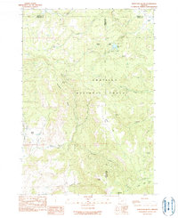
1990 Map of Whitetail Butte
USGS Topo · Published 1990About this map
The Umatilla National Forest dominates this high-altitude landscape where Wheeler, Morrow, and Grant counties converge. The terrain is defined by a series of prominent peaks and ridges, including Whitetail Butte, Mahogany Butte, and Tamarack Mtn, which overlook a network of seasonal and perennial drainages. A notable concentration of water sources is evident through numerous named springs such as Whitetail Spring, Fairview Spring, and Yearling Spring, which likely served as critical points for both wildlife and early high-country travelers. At the heart of the area, Bull Prairie Lake provides a central landmark amidst the forest. The map reflects a landscape primarily dedicated to resource management and natural preservation, with a heavy emphasis on topography and water distribution across the Rocky Flat and Kahler Basin areas. The naming conventions, such as Happy Jack Ridge and Burnt Cabin Creek, hint at the local lore and early exploration of these Oregon uplands.
Find a feature on this map
34 named features on this map. Tap any name to fly to it.
Don’t see what you’re looking for? This feature index may not catch every label — zoom into the map to look around manually.
Map Details
Editions of this 1990 Whitetail Butte Map
This is the sole edition of this map. No revisions or reprints were ever made.
Other maps of this area

1953 · Kimberly
USGS Topo · 1:62,500

1953 · Spray
USGS Topo · 1:62,500

1953 · Pendleton
USGS Topo · 1:250,000

1955 · Canyon City
USGS Topo · 1:250,000

1956 · Pendleton
USGS Topo · 1:250,000

1959 · Canyon City
USGS Topo · 1:250,000

1969 · Lefevre Prairie
USGS Topo · 1:24,000

1969 · Chapin Creek
USGS Topo · 1:24,000

1969 · Big Rock Flat
USGS Topo · 1:24,000

1980 · Monument
USGS Topo · 1:100,000