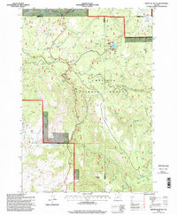
1995 Map of Whitetail Butte
USGS Topo · Published 1998About this map
Umatilla National Forest dominates this mid-1990s landscape, where high ridgelines and deep creek basins converge at the intersection of Wheeler, Morrow, and Grant counties. The map captures a backcountry environment defined by water management and natural landmarks, including the notable Bull Prairie Lake and its accompanying boat ramp. The terrain is punctuated by significant volcanic features such as Whitetail Butte, Mahogany Butte, and Stalling Butte, alongside the broad expanse of Kahler Basin.
Find a feature on this map
33 named features on this map. Tap any name to fly to it.
Don’t see what you’re looking for? This feature index may not catch every label — zoom into the map to look around manually.
Map Details
Editions of this 1995 Whitetail Butte Map
This is the sole edition of this map. No revisions or reprints were ever made.
Other maps of this area

1953 · Kimberly
USGS Topo · 1:62,500

1953 · Spray
USGS Topo · 1:62,500

1953 · Pendleton
USGS Topo · 1:250,000

1955 · Canyon City
USGS Topo · 1:250,000

1956 · Pendleton
USGS Topo · 1:250,000

1959 · Canyon City
USGS Topo · 1:250,000

1969 · Lefevre Prairie
USGS Topo · 1:24,000

1969 · Chapin Creek
USGS Topo · 1:24,000

1969 · Big Rock Flat
USGS Topo · 1:24,000

1980 · Monument
USGS Topo · 1:100,000