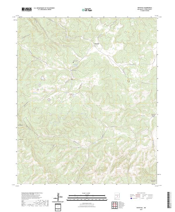
2023 Map of Whitetail
USGS Topo · Published 2023About this map
Whitetail serves as a central hub in this high-elevation landscape of the Sacramento Mountains. The area's geography is defined by a dense network of Bureau of Indian Affairs routes, such as Indian Svc Rte 18 and Indian Svc Rte 28, which navigate the complex system of canyons and ridges. For genealogists and local historians, the Whitetail Cem is a significant landmark situated near Whitetail Tank. The reliance on local water sources is evident through numerous named features like Whitetail Springs, Whitetail Lake, and several livestock tanks including Woody Tank and Pine Tank. Rising above the drainages of Summit Canyon and Pauls Canyon, the terrain reaches its peak at Harley Mtn, illustrating the high-country character of Otero County.
Find a feature on this map
38 named features on this map. Tap any name to fly to it.
Don’t see what you’re looking for? This feature index may not catch every label — zoom into the map to look around manually.
Map Details
Editions of this 2023 Whitetail Map
This is the sole edition of this map. No revisions or reprints were ever made.
Other maps of this area

1955 · Roswell
USGS Topo · 1:250,000

1958 · Roswell
USGS Topo · 1:250,000

1961 · Lincoln
USGS Topo · 1:62,500

1962 · Roswell
USGS Topo · 1:250,000

1963 · Turkey Peak
USGS Topo · 1:24,000

1963 · Ruidoso Downs
USGS Topo · 1:24,000

1963 · Ruidoso
USGS Topo · 1:24,000
1963 · Pajarita Mountain
USGS Topo · 1:24,000

1963 · Firman Canyon
USGS Topo · 1:24,000

1963 · Apache Summit
USGS Topo · 1:24,000