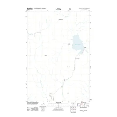
2011 Map of Whitetail Peak
USGS Topo · Published 2011About this map
Whitetail Peak dominates this landscape in Jefferson County, where the 2011 survey documents a high-altitude terrain defined by hydrologic infrastructure and mountain meadows. The most prominent feature is the Whitetail Reservoir, held by the Whitetail Dam, which feeds into Little Whitetail Creek. Evidence of grazing and land management is seen in the Stockmens Association Cabin, while the geography is punctuated by open alpine clearings such as Bakers Meadows, Halfway Park, and Lost Park. Resource extraction is recorded through several identified mining sites including the NW NW Section 13 Mine and the SW SW Section 14 Mine. Multiple drainage systems, including Nez Perce Creek and International Creek, cross the terrain, illustrating the complex watershed of this mountain region.
Find a feature on this map
21 named features on this map. Tap any name to fly to it.
Don’t see what you’re looking for? This feature index may not catch every label — zoom into the map to look around manually.
Map Details
Editions of this 2011 Whitetail Peak Map
This is the sole edition of this map. No revisions or reprints were ever made.
Other maps of this area

1889 · Helena
USGS Topo · 1:250,000

1893 · Helena
USGS Topo · 1:250,000

1893 · Dillon
USGS Topo · 1:250,000

1899 · Boulder
USGS Topo · 1:125,000

1899 · Helena
USGS Topo · 1:250,000

1903 · Helena
USGS Topo · 1:250,000

1947 · Butte
USGS Topo · 1:250,000

1954 · Elk Park
USGS Topo · 1:62,500

1954 · Boulder
USGS Topo · 1:62,500

1955 · Dillon
USGS Topo · 1:250,000