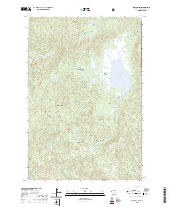
2024 Map of Whitetail Peak
USGS Topo · Published 2024About this map
Whitetail Peak rises as a central landmark within this portion of the Deerlodge National Forest, where the high-altitude drainage systems of the Boulder Mountains define the landscape. The hydrography of the region is anchored by the Whitetail Reservoir to the east, fed by Little Whitetail Creek and surrounded by a network of seasonal and perennial flows including International Creek and Nez Perce Creek. The map documents a series of high mountain meadows or "parks," such as Little Boulder Park, Upper Whitetail Park, and Halfway Park, which historically served as vital clearings in the dense forest. Traverse through the area is primarily represented by the Continental Divide National Scenic Trl, which winds across the southwestern ridges, following the natural hydrological divide of the continent.
Find a feature on this map
22 named features on this map. Tap any name to fly to it.
Don’t see what you’re looking for? This feature index may not catch every label — zoom into the map to look around manually.
Map Details
Editions of this 2024 Whitetail Peak Map
This is the sole edition of this map. No revisions or reprints were ever made.
Other maps of this area

1889 · Helena
USGS Topo · 1:250,000

1893 · Helena
USGS Topo · 1:250,000

1893 · Dillon
USGS Topo · 1:250,000

1899 · Boulder
USGS Topo · 1:125,000

1899 · Helena
USGS Topo · 1:250,000

1903 · Helena
USGS Topo · 1:250,000

1947 · Butte
USGS Topo · 1:250,000

1954 · Elk Park
USGS Topo · 1:62,500

1954 · Boulder
USGS Topo · 1:62,500

1955 · Dillon
USGS Topo · 1:250,000