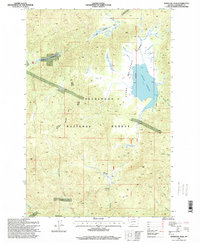
1996 Map of Whitetail Peak
USGS Topo · Published 1998About this map
Deerlodge National Forest dominates this mountain landscape, which is characterized by high peaks and an intricate network of drainage creeks in Jefferson County. The central feature is the Upper Whitetail Reservoir, a significant water body created by a dam and Spillway that feeds into Whitetail Creek. This area serves as a rugged intersection of wilderness and early industrial exploration, evidenced by numerous prospects and specialized mining sites like Prospect X scattered throughout the high elevations. Local ranching history is anchored by the Stockmens Association Cabin, located east of the reservoir near the Guide Meridian. From the alpine heights of Whitetail Peak to the riparian flats of Bakers Meadows, the map reveals a terrain where water management and mineral search defined the human presence within the national forest.
Find a feature on this map
20 named features on this map. Tap any name to fly to it.
Don’t see what you’re looking for? This feature index may not catch every label — zoom into the map to look around manually.
Map Details
Editions of this 1996 Whitetail Peak Map
This is the sole edition of this map. No revisions or reprints were ever made.
Other maps of this area

1889 · Helena
USGS Topo · 1:250,000

1893 · Helena
USGS Topo · 1:250,000

1893 · Dillon
USGS Topo · 1:250,000

1899 · Boulder
USGS Topo · 1:125,000

1899 · Helena
USGS Topo · 1:250,000

1903 · Helena
USGS Topo · 1:250,000

1947 · Butte
USGS Topo · 1:250,000

1954 · Elk Park
USGS Topo · 1:62,500

1954 · Boulder
USGS Topo · 1:62,500

1955 · Dillon
USGS Topo · 1:250,000