
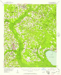
1955 Map of Whiteville
USGS Topo · Published 1955About this map
Whiteville serves as the hub of this mid-century coastal plain landscape, where the Atlantic Coast Line and Seaboard Coast Line railroads intersect to define the local economy. The terrain is characterized by an intricate network of Carolina bays and swampy depressions, including Raven Bay, Cypress Bay, and the expansive Brown Marsh. To the southeast, the waters of Lake Waccamaw dominate the view near Wananish. Rural life is anchored by family-named landmarks and community institutions like the Farmers Union Sch, Porterville (Emerson PO), and Hickory Hill Sch. The presence of Richardson Millpond and the State Prison Camp No 602 near South Whiteville provides specific points of interest for local historians tracking the industrial and social footprint of Bladen and Columbus counties during this era.
Find a feature on this map
107 named features on this map. Tap any name to fly to it.
Don’t see what you’re looking for? This feature index may not catch every label — zoom into the map to look around manually.
Map Details
Editions of this 1955 Whiteville Map
2 editions found
Other maps of this area

1942 · Juniper Creek
USGS Topo · 1:24,000

1943 · Nakina
USGS Topo · 1:24,000

1953 · Chadbourn
USGS Topo · 1:62,500

1953 · Florence
USGS Topo · 1:250,000

1954 · Florence
USGS Topo · 1:250,000

1954 · White Lake
USGS Topo · 1:62,500

1954 · Bolton
USGS Topo · 1:62,500

1955 · Elizabethtown
USGS Topo · 1:62,500

1957 · Bladenboro
USGS Topo · 1:62,500
1962 · Tabor City East
USGS Topo · 1:24,000