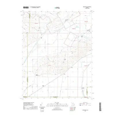
2017 Map of Whitewater
USGS Topo · Published 2017About this map
The Castor River Diversion Channel dominates this landscape in Cape Girardeau and Bollinger Counties, cutting a direct path across the terrain to manage the flow of local waterways. Near the junction of the Upper Whitewater Cr and this massive engineering project lies Whitewater, while the settlement of Allenville sits to the east, bordered by the seasonal waters of Horseshoe Bend Slough. This region is characterized by a mix of low-lying wetlands and elevated features like Hickory Ridge, where the agricultural grid is punctuated by numerous family and community burial grounds.
Find a feature on this map
82 named features on this map. Tap any name to fly to it.
Don’t see what you’re looking for? This feature index may not catch every label — zoom into the map to look around manually.
Map Details
Editions of this 2017 Whitewater Map
This is the sole edition of this map. No revisions or reprints were ever made.
Other maps of this area

1922 · Cape Girardeau
USGS Topo · 1:62,500

1924 · Cape Girardeau
USGS Topo · 1:62,500

1933 · Marble Hill
USGS Topo · 1:62,500

1934 · Morley
USGS Topo · 1:62,500

1934 · Advance
USGS Topo · 1:62,500

1937 · Marble Hill
USGS Topo · 1:62,500

1939 · Morley
USGS Topo · 1:62,500

1939 · Advance
USGS Topo · 1:62,500

1949 · Paducah
USGS Topo · 1:250,000

1950 · Paducah
USGS Topo · 1:250,000