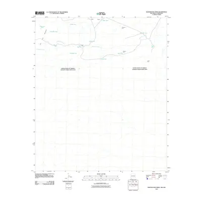
2010 Map of Whitewater Creek
USGS Topo · Published 2010About this map
The San Luis Mountains dominate the western edge of this arid landscape where the border between the United States of America and Estados Unidos Mexicanos divides the terrain. Water management is the primary marker of human activity, with a network of cattle tanks and draws scattered across the ranching country. Key landmarks include the T Pendleton Ranch in the north and the W E Bass Ranch and R I Bass Ranch to the east, reflecting the heritage of large-scale southwestern livestock operations.
Find a feature on this map
20 named features on this map. Tap any name to fly to it.
Don’t see what you’re looking for? This feature index may not catch every label — zoom into the map to look around manually.
Map Details
Editions of this 2010 Whitewater Creek Map
This is the sole edition of this map. No revisions or reprints were ever made.
Other maps of this area

1917 · Antelope Wells
USGS Topo · 1:62,500

1918 · Cienega Springs
USGS Topo · 1:62,500

1919 · Antelope Wells
USGS Topo · 1:62,500

1955 · Douglas
USGS Topo · 1:250,000

1959 · Douglas
USGS Topo · 1:250,000

1961 · Douglas
USGS Topo · 1:250,000

1964 · Douglas
USGS Topo · 1:250,000
1982 · Fitzpatricks
USGS Topo · 1:24,000
1982 · Hilo Peak
USGS Topo · 1:24,000
1982 · San Luis Pass
USGS Topo · 1:24,000