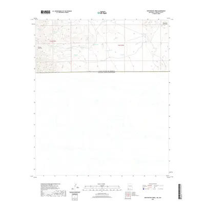
2020 Map of Whitewater Creek
USGS Topo · Published 2020About this map
The San Luis Mountains and Whitewater Mountains dominate the northern landscape of this borderland region in Hidalgo County. This arid environment is defined by its water management, evidenced by numerous named catchment basins such as Prospector Tank, Boyles Tank, and Chavez Tank. These features suggest a history of ranching and livestock management in a territory where permanent water is scarce. Whitewater Cr winds through the central terrain, carving through the high country before the land slopes toward the international boundary.
Find a feature on this map
19 named features on this map. Tap any name to fly to it.
Don’t see what you’re looking for? This feature index may not catch every label — zoom into the map to look around manually.
Map Details
Editions of this 2020 Whitewater Creek Map
This is the sole edition of this map. No revisions or reprints were ever made.
Other maps of this area

1917 · Antelope Wells
USGS Topo · 1:62,500

1918 · Cienega Springs
USGS Topo · 1:62,500

1919 · Antelope Wells
USGS Topo · 1:62,500

1955 · Douglas
USGS Topo · 1:250,000

1959 · Douglas
USGS Topo · 1:250,000

1961 · Douglas
USGS Topo · 1:250,000

1964 · Douglas
USGS Topo · 1:250,000
1982 · Fitzpatricks
USGS Topo · 1:24,000
1982 · Hilo Peak
USGS Topo · 1:24,000
1982 · San Luis Pass
USGS Topo · 1:24,000