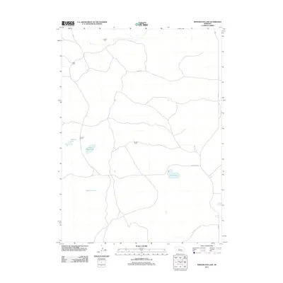
2011 Map of Whitewater Lake
USGS Topo · Published 2011About this map
Kramer Ranch and Tucker Ranch anchor the northern landscape of this Nebraska Sandhills region, where cattle ranching remains the primary architectural and economic driver. This 2011 survey reveals a territory defined by isolated family operations and seasonal hydrology, as seen in the cluster of small water bodies like Stickney Lake and Sand Beach Lake. The local road network is utilitarian and sparse, primarily consisting of unpaved tracks such as Kramer Rd and Soddy Rd that connect the remote outposts. Further south, the map is dominated by the namesake Whitewater Lake and the nearby Dry Lake, illustrating the fluctuating nature of groundwater and drainage in this distinct prairie ecosystem. The layout of Bassett Ranch and Pinkerton Ranch further reflects the vast spatial requirements of life in Hooker County.
Find a feature on this map
11 named features on this map. Tap any name to fly to it.
Don’t see what you’re looking for? This feature index may not catch every label — zoom into the map to look around manually.
Map Details
Editions of this 2011 Whitewater Lake Map
This is the sole edition of this map. No revisions or reprints were ever made.
Other maps of this area

1947 · Dismal River Ranch
USGS Topo · 1:62,500

1948 · Carr Lake
USGS Topo · 1:62,500

1949 · Dismal River Ranch
USGS Topo · 1:62,500

1949 · Flats
USGS Topo · 1:62,500

1949 · Wright Valley
USGS Topo · 1:62,500

1950 · Flats
USGS Topo · 1:62,500

1950 · Carr Lake
USGS Topo · 1:62,500

1951 · Wright Valley
USGS Topo · 1:62,500

1954 · North Platte
USGS Topo · 1:250,000

1956 · North Platte
USGS Topo · 1:250,000