
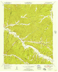
1936 Map of Whitfield
USGS Topo · Published 1936About this map
The winding Duck River and Piney River dominate this 1936 survey of Hickman County, capturing a landscape defined by deep-set bends and narrow hollows. Settled along these waterways are numerous family-named landmarks and rural institutions, from the small community at Whitfield to the Briggs Chapel and Lowe Bend Sch further inland. The river's influence is clear in the naming of large topographical features like Whitson Bend and Council Bend, as well as several prominent islands including Lovett Island and Carothers Island.
Find a feature on this map
72 named features on this map. Tap any name to fly to it.
Don’t see what you’re looking for? This feature index may not catch every label — zoom into the map to look around manually.
Map Details
Editions of this 1936 Whitfield Map
This is the sole edition of this map. No revisions or reprints were ever made.
Other maps of this area

1901 · Colombia
USGS Topo · 1:125,000

1936 · Pleasantville
USGS Topo · 1:24,000

1936 · Coble
USGS Topo · 1:24,000

1936 · Beaverdam Springs
USGS Topo · 1:24,000

1936 · Nunnelly
USGS Topo · 1:24,000

1936 · Sunrise
USGS Topo · 1:24,000

1936 · Bucksnort
USGS Topo · 1:24,000

1936 · Texas Hollow
USGS Topo · 1:24,000

1936 · Spot
USGS Topo · 1:24,000
1951 · Pleasantville
USGS Topo · 1:24,000