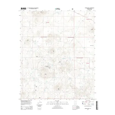
2014 Map of Whiting Knoll
USGS Topo · Published 2014About this map
Apache National Forest lands dominate this high-altitude landscape in eastern Arizona, characterized by a series of volcanic features and numerous mountain springs. The terrain rises to prominent summits like Whiting Knoll, Saint Peters Dome, and Cerro Montoso, while the lower elevations are marked by seasonal drainages such as Whiting Wash and Wildcat Cr. The presence of small, localized settlements such as Potato Patch and Udall Park suggests a history of cattle ranching or seasonal high-country occupation.
Find a feature on this map
66 named features on this map. Tap any name to fly to it.
Don’t see what you’re looking for? This feature index may not catch every label — zoom into the map to look around manually.
Map Details
Editions of this 2014 Whiting Knoll Map
This is the sole edition of this map. No revisions or reprints were ever made.
Other maps of this area

1886 · St Johns
USGS Topo · 1:250,000

1892 · St Johns
USGS Topo · 1:250,000

1954 · Saint Johns
USGS Topo · 1:250,000

1957 · Saint Johns
USGS Topo · 1:250,000

1958 · Saint Johns
USGS Topo · 1:250,000

1962 · Saint Johns
USGS Topo · 1:250,000

1968 · Boundary Butte
USGS Topo · 1:24,000

1968 · Springerville NW
USGS Topo · 1:24,000

1969 · Whiting Knoll
USGS Topo · 1:24,000
1969 · Greer
USGS Topo · 1:24,000