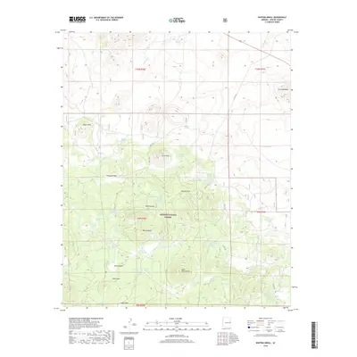
2018 Map of Whiting Knoll
USGS Topo · Published 2018About this map
Apache National Forest lands dominate this high-altitude landscape in eastern Arizona, where a complex network of volcanic peaks and canyons dictates the water distribution across the high desert. Prominent landmarks such as Whiting Knoll, Saint Peters Dome, and Negro Knob rise above a terrain punctuated by isolated springs and livestock tanks. The area shows a clear reliance on strategic water sources like Mineral Springs, Neal Spring, and Ojo Gato Spring, which are essential features in this arid environment.
Find a feature on this map
63 named features on this map. Tap any name to fly to it.
Don’t see what you’re looking for? This feature index may not catch every label — zoom into the map to look around manually.
Map Details
Editions of this 2018 Whiting Knoll Map
This is the sole edition of this map. No revisions or reprints were ever made.
Other maps of this area

1886 · St Johns
USGS Topo · 1:250,000

1892 · St Johns
USGS Topo · 1:250,000

1954 · Saint Johns
USGS Topo · 1:250,000

1957 · Saint Johns
USGS Topo · 1:250,000

1958 · Saint Johns
USGS Topo · 1:250,000

1962 · Saint Johns
USGS Topo · 1:250,000

1968 · Boundary Butte
USGS Topo · 1:24,000

1968 · Springerville NW
USGS Topo · 1:24,000

1969 · Whiting Knoll
USGS Topo · 1:24,000
1969 · Greer
USGS Topo · 1:24,000