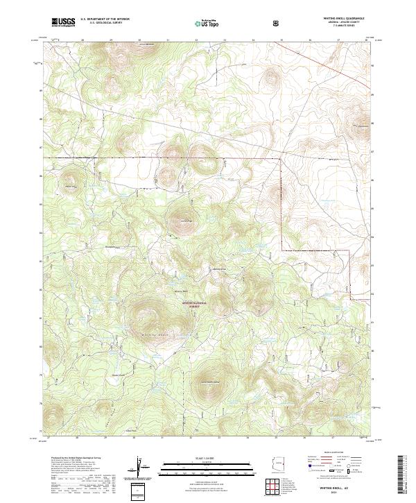
2021 Map of Whiting Knoll
USGS Topo · Published 2021About this map
The Apache National Forest dominates this landscape of the White Mountains region, where a complex network of springs and drainage draws defines the high-altitude terrain. The topography is marked by several prominent volcanic features, including Saint Peters Dome, Negro Knob, and Whiting Knoll. Water management is a primary characteristic of the area, evidenced by numerous named tanks such as Cerro Trigo Tank and Halls Tank Number Three, which serve as vital resources in this arid environment. The presence of Potato Patch and Sawmill Spring suggests localized histories of cultivation and early timber work tucked within the draws. Movement across the forest is facilitated by a grid of numbered forest routes like Ap-1327 and Co RD 3123, which navigate around rugged volcanic landmarks like Cerro Montoso and through valleys like Udall Draw.
Find a feature on this map
62 named features on this map. Tap any name to fly to it.
Don’t see what you’re looking for? This feature index may not catch every label — zoom into the map to look around manually.
Map Details
Editions of this 2021 Whiting Knoll Map
This is the sole edition of this map. No revisions or reprints were ever made.
Other maps of this area

1886 · St Johns
USGS Topo · 1:250,000

1892 · St Johns
USGS Topo · 1:250,000

1954 · Saint Johns
USGS Topo · 1:250,000

1957 · Saint Johns
USGS Topo · 1:250,000

1958 · Saint Johns
USGS Topo · 1:250,000

1962 · Saint Johns
USGS Topo · 1:250,000

1968 · Boundary Butte
USGS Topo · 1:24,000

1968 · Springerville NW
USGS Topo · 1:24,000

1969 · Whiting Knoll
USGS Topo · 1:24,000
1969 · Greer
USGS Topo · 1:24,000