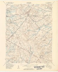
1949 Map of Whiting
USGS Topo · Published 1954About this map
Whiting serves as a central hub in the mid-century Pine Barrens, where the Central Railroad of New Jersey intersects a network of sand roads and early highways. The landscape is defined by its industrial and military transitions, from the northern reach of the Fort Dix Military Reservation to specialized sites like the Clay Works near Pasadena. This 1949 survey illustrates a region largely dominated by conservation and resource extraction, with vast tracts of the Lebanon State Forest and Penn State Forest preserving the characteristic sandy plains and winding cedar watercourses.
Find a feature on this map
75 named features on this map. Tap any name to fly to it.
Don’t see what you’re looking for? This feature index may not catch every label — zoom into the map to look around manually.
Map Details
Editions of this 1949 Whiting Map
3 editions found
Other maps of this area

1884 · Whitings
USGS Topo · 1:62,500

1888 · Bordentown
USGS Topo · 1:62,500

1888 · Pemberton
USGS Topo · 1:62,500

1888 · Barnegat
USGS Topo · 1:62,500

1888 · Little Egg Harbor
USGS Topo · 1:62,500

1888 · Asbury Park
USGS Topo · 1:62,500

1888 · Cassville
USGS Topo · 1:62,500

1888 · Long Beach
USGS Topo · 1:62,500

1888 · Whitings
USGS Topo · 1:62,500

1890 · Mullica
USGS Topo · 1:62,500