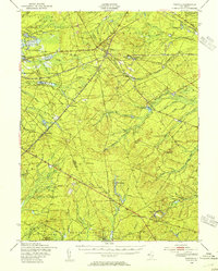
1949 Map of Whiting
USGS Topo · Published 1954About this map
The Central Railroad of New Jersey and the Pennsylvania Railroad intersect at the village of Whiting, forming a major transit point through the pine-dominated landscape of mid-century Ocean and Burlington Counties. This post-war survey reveals a region defined by extensive public lands and industrial footprints, including the edge of the Fort Dix Military Reservation and the sprawling Lebanon State Forest. To the south, the West Plains represent a unique ecological terrain, while scattered settlements like Woodmansie and Pasadena sit alongside rail lines that served the local economy. Local industry and specialized land use are evident at the Clay Works and the religious retreat at Keswick Grove. Numerous cedar swamps and winding watercourses such as Pole Bridge Branch and Webbs Mill Branch illustrate the intricate hydrology that long supported the area's specialized agriculture and bog-iron history.
Find a feature on this map
84 named features on this map. Tap any name to fly to it.
Don’t see what you’re looking for? This feature index may not catch every label — zoom into the map to look around manually.
Map Details
Editions of this 1949 Whiting Map
3 editions found
Other maps of this area

1884 · Whitings
USGS Topo · 1:62,500

1888 · Bordentown
USGS Topo · 1:62,500

1888 · Pemberton
USGS Topo · 1:62,500

1888 · Barnegat
USGS Topo · 1:62,500

1888 · Little Egg Harbor
USGS Topo · 1:62,500

1888 · Asbury Park
USGS Topo · 1:62,500

1888 · Cassville
USGS Topo · 1:62,500

1888 · Long Beach
USGS Topo · 1:62,500

1888 · Whitings
USGS Topo · 1:62,500

1890 · Mullica
USGS Topo · 1:62,500