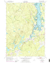
1949 Map of Whiting
USGS Topo · Published 1978About this map
The Moosehorn National Wildlife Refuge dominates this coastal Maine landscape, preserving a complex network of freshwater lakes and tidal inlets. The Orange River flows from Orange Lake through the heart of the township of Whiting, connecting a series of smaller water bodies including Little Lake and Roaring Lake. This area represents a critical intersection of inland hydrology and the Atlantic, where numerous brooks like Crane Mill Brook and Cranberry Brook feed into the expansive Whiting Bay.
Find a feature on this map
59 named features on this map. Tap any name to fly to it.
Don’t see what you’re looking for? This feature index may not catch every label — zoom into the map to look around manually.
Map Details
Editions of this 1949 Whiting Map
3 editions found

Other maps of this area

1907 · Eastport
USGS Topo · 1:48,000

1908 · Eastport
USGS Topo · 1:62,500

1917 · Cutler
USGS Topo · 1:62,500

1918 · Machias
USGS Topo · 1:62,500

1918 · Cutler
USGS Topo · 1:62,500

1941 · Machias
USGS Topo · 1:62,500

1941 · Gardner Lake
USGS Topo · 1:62,500

1943 · Gardner Lake
USGS Topo · 1:62,500

1943 · Eastport
USGS Topo · 1:62,500

1945 · Eastport
USGS Topo · 1:62,500