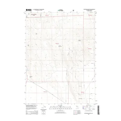
2015 Map of Whitinger Mountain
USGS Topo · Published 2015About this map
Modoc National Forest encompasses the northern high-country terrain of this Lassen County map, dominated by the prominent peak of Whitinger Mountain. The landscape is defined by wide volcanic basins and ridges, including the broad expanse of Grasshopper Valley and the distinctive Dry Valley Ridge. Water management is evident in the presence of the Said Valley Reservoir and the isolated Bath Spring near Diaz Flat. A network of forest and ranching roads is meticulously named, often using avian and animal themes such as Oriole, Finch, Raccoon Rd, and Possum Rd. This survey shows the modern land management of the Modoc plateau, where topographical features like Spooner Trough Canyon and South Knob serve as primary landmarks in an area otherwise marked by significant open space and public forest lands.
Find a feature on this map
36 named features on this map. Tap any name to fly to it.
Don’t see what you’re looking for? This feature index may not catch every label — zoom into the map to look around manually.
Map Details
Editions of this 2015 Whitinger Mountain Map
This is the sole edition of this map. No revisions or reprints were ever made.
Other maps of this area

1886 · Alturas
USGS Topo · 1:250,000

1886 · Honey Lake
USGS Topo · 1:250,000

1891 · Honey Lake
USGS Topo · 1:250,000

1892 · Alturas
USGS Topo · 1:250,000

1893 · Honey Lake
USGS Topo · 1:250,000

1954 · Grasshopper Valley
USGS Topo · 1:62,500

1954 · Alturas
USGS Topo · 1:250,000

1955 · Westwood
USGS Topo · 1:250,000

1956 · Hayden Hill
USGS Topo · 1:62,500

1958 · Alturas
USGS Topo · 1:250,000